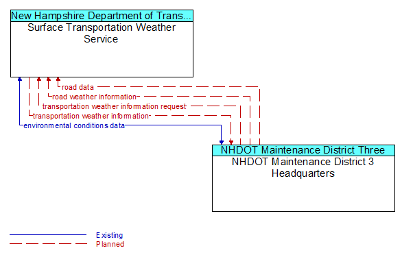
Interface: Surface Transportation Weather Service - NHDOT Maintenance District 3 Headquarters

Architecture Flow Definitions
environmental conditions data (Existing) Applicable ITS Standards
Current road conditions (e.g., surface temperature, subsurface temperature, moisture, icing, treatment status) and surface weather conditions (e.g., air temperature, wind speed, precipitation, visibility) as measured and reported by fixed and/or mobile environmental sensors and aggregated by the data collector. Attributes relating to the data collection (and aggregation) are also included.
road data (Planned) Applicable ITS Standards
Basic road facility and treatment information that supports road conditions forecasts.
road weather information (Planned) Applicable ITS Standards
Road conditions and weather information that are made available by road maintenance operations to other transportation system operators.
transportation weather information (Planned) Applicable ITS Standards
Current and forecast road conditions and weather information (e.g., surface condition, flooding, wind advisories, visibility, etc.) associated with the transportation network. This information is of a resolution, timeliness, and accuracy to be useful in transportation decision making.
transportation weather information request (Planned) Applicable ITS Standards
A request for transportation weather information that may specify the area of interest (a geographic region, particular routes within a region, specific road segments), the type of information that is required, the desired spatial resolution of the information, and time horizon.